
Table of contents:
|
|
| Table of contents: |
|
2. General information about the Fläming
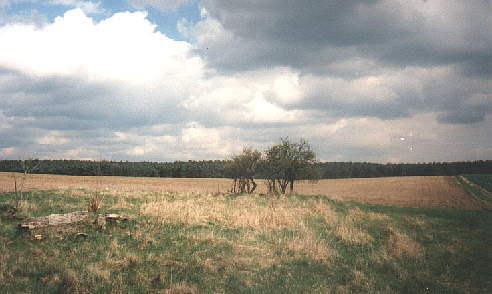
The soft hills, the forests with pines - that is the Fläming
![]()
2. General information about the Fläming
The Fläming is a "Diluvialplateau" that spreads out with a length of 116 km and a breadth of 30 km. In the south it touches the river Elbe.
The Fläming is divided into the High Fläming and Low Fläming. The border goes through the headwaters of the river Nuthe near Dennewitz. While you can find in the High Fläming more forests in the Low Fläming there are more fields. The highest elevation is the "Hagelberg" near Belzig. It is 201 m high.
The High Fläming is divided into several regions for instance Garreyer Rummel, Planetal and Klein Marzehns. The border of the Fläming goes along between the federal states of Brandenburg and Sachsen-Anhalt.
![]()
The geological beginning of the Fläming you will find during the last glacial period. At this time a lot of ice comes from Scandinavia and brings stones, gravel and scree to us. The ice begins to melt. Huge areas with debris are left. The first stratum of our earth thaws and masses of water force its way through grooves. The ground begins to slide, steep inclinations become soft slopes. Over centuries the vegetation begins to grow. Deep grooves of the erosion become dry valleys that are called "Rummeln" today. These Rummeln and huge erratic blocks form the actual character of the Fläming. Slowly the human being takes possession of the nature. The first settlers are Teutonic tribes that go to the southwest afterwards. In the 6th and 7th century Slav tribes come to the Fläming. Today many names of towns or villages remind of them: Görzke, Niemegk, Belzig... . Later German armies penetrate into the east.
![]()
In the Fläming you can see many sights.
Görzke is located in the northwest of the Fläming near Wiesenburg.
In former times the people used to produce many different things made of clay. There were large-scale enterprises as well as family businesses. Today not so many products are manufactured but the tradition is carried on.
Each year at Easter there is a market of pottery at Görzke.
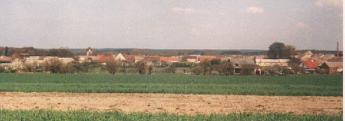
The village of Görzke
![]()
Ziesar is a town in the northwest of the Fläming not far away from Görzke.
In 949 the castle Ezeri is mentioned for the first time. Lost in a rebellion of Slavs it is recaptured in the 12th century. Then it is residence of an archbishop. At this time when Balduin a bishop alters the castle in 1213 it has seven towers and many walls and moats. After an occupation in the year of 1220 it is again residence of the bishops of Brandenburg.
In 1337 Ziesar gets the rights of a town and in 1470 the chapel of the castle is consecrated. In 1713 there are still five towers in good condition left. In 1722 the government sells the castle and its vicinity.
After several other owners Rittergutsbesitzer von Sachsenburg purchases the castle. Later he is expropriated in the cause of the land reform in 1945.
Afterwards a boarding school is in the castle.
![]()
Jüterbog is a town in the Low Fläming.
Although there are already settlements near Jüterbog around 4200 years before Christ they are mentioned for the first time not until 1007.
In 1447 there rages a fire in the town. After the reconstruction in 1520 Jüterbog is a town in the Gothic style. The Thirty Years' War interrupts the time of prosperity of the town.
After the Seven Years' War the monastery Zinna is founded in front of the town gate of Jüterbog. During an air raid on Jüterbog in 1945 the town centre is spared.
![]()
Belzig is located in the north of the High Fläming.
Until 997 Belzig is a Slav town. Then it is populated by German conquerors. Afterwards emperor Otto III. gives the town to a religious institution of Magdeburg.
Under cover of the castle that is known since 1161 two settlements develop. Until the 17th century weaving and brewery are the most important sources of income. In 1406 Belzig is destroyed in the course of armed conflicts. Another destruction takes place in 1636 during the Thirty Years' War because of a fire. In 1684 the castle is reconstructed. Belzig gets the rights of a town in 1702 and on 27 August 1813 Napoleon is defeated at the Hagelberg near Belzig.
Since 1815 Belzig belongs to the province of Brandenburg and is a district town. Because of that reason the town becomes the most important town of the High Fläming.
There are also some sights in Belzig to visit. So you can see the "Bricciuskapelle". It is mentioned in 1161 for the first time and at this time it probable belongs to the chapel of the castle. In the 15th and 17th century there are altered sections that give the chapel its present look. In the chapel you can see an altar and painted galleries. The Marienkirche is built during the first half of the 13th century. After a destruction in 1636 it is reconstructed in the style of renaissance. After 230 years a restoration in the style of New Gothic takes place. In the church you can look at an altar with paintings and a pulpit. This pulpit is created in 1659/1660 by Ch. Witt and shows 15 pictures of the life of Jesus von Nazareth.
The Heiliggeist-Hospital is built in 1383 and reconstructed in 1776.
In the old town there are very old buildings.
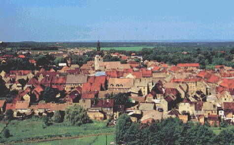
The view of Belzig
![]()
The Bricciuskapelle that is mentioned in 1161 for the first time stands above the castle today and gives the mountain where the castle stands his name: the mountain of Briccius.
Around 1161 the counts of Belzig start to build a Romanesque castle. This one is smaller than the form of today. The tower of the castle is called "Butterturm" and has a high of 33 m. Twelve meters over the ground is the only entrance that is reached with the help of a leader. Later a comfortable entrance is built. In the tower you can find a fireside and a miscarriage.
In 1250 the counts of Belzig die out. So the area of Belzig is owned by the dukes of Saxony who give the property to the archbishop of Magdeburg in 1278. In 1298 the castle is again the residence of the dukes of Saxony. After 1467 the castle is built in a new form. Its building owner elector Ernst of Saxony build a fortress with very wide walls. At the corners of this hexagon five towers with diameters of 11 to 23 m and with embrasures are located. The entrance is between two semicircular towers. The castle is called "Eisenhardt" because its walls are hard like iron. Since the Thirty Years' War Eisenhardt is outdated. Because of that reason the cellar is used as a warehouse for salt and the castle is residence of several offices.
During the war against Napoleon Napoleon is defeated on 27 August 1813 near the castle. In 1849 the castle’s tower is repaired and after 1945 it is a museum, a school and a youth hostel.
In 1997 Belzig celebrates that the castle was built thousand years ago. Because of that reason a hotel is opened. In the museum you can see a model of the battle against Napoleon at the Hagelberg.
![]()
During the second half of the 12th century people build a round or oval castle that has a tower with a high of 48 m. This tower protects the most endangered place of the castle: the door. The entrance of the tower is located 12 m over the ground. Today it is walled up and a comfortable entrance is built. Inside the tower you can see remnants of a chimney and of stairs.
In 1161 the castle is mentioned for the first time. Since the beginning of the 13th century it is a fief of the archbishops of Magdeburg. Since 1288 several families who owned the castle are known until elector Rudolf of Saxony purchases the castle by buying and exchange. Since 1456 Saxon electors lend the castle to the family Brandt who is called Brandt von Lindau since the 16th century. This family works very hard. Because of that reason the region is also called "Brandtsheide". During the war of Schmalkalden in 1547 the castle is conquered and burned down. After 1550 while reconstructing the castle a palace in the style of Renaissance develops. The family Brandt von Lindau reconstructs also neighbouring villages and so its estate becomes a profitable enterprise.
Between 1618 and 1648 is the Thirty Years' War. During these years the time of prosperity of Wiesenburg is interrupted. The law of succession supports the decline. In 1636 the palace is destroyed for another time. But later it is reconstructed.
Between 1730 and 1740 there is a great altered section. During this time the palace gets his actual form apart from the western side. From 1864 to 1866 the palace is altered for another time with the leadership of Otto Mothes. Because of that reason the southern side with a park develops. This side is constructed in the style of New Renaissance and it has great outdoor steps.
In 1879/1880 people build the western tower. In 1992 the whole palace is restored. Today you can see many decorations above entrances, the well of the palace, the stairs inside the tower, different portals and other special qualities.
The park of the palace is created by Kurt von Watzdorf. He lays it out with Gebbers a botanist and forester. You can find there very seldom trees that come from China and Japan. There are also very big trees that are nearly 500 years old. In 1878 people build a terrace with a grotto.
The palace has a church, too. There you can visit the tombs of the family Brandt von Lindau. Besides there is a gallery with paintings from 1594 and an organ from 1775.
Visiting the palace is very profitable.
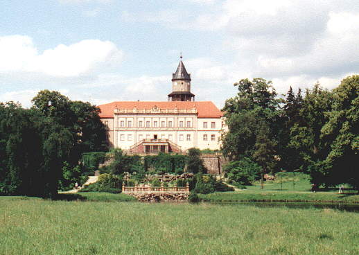
The palace of Wiesenburg
![]()
Rabenstein is located near the village of Raben in the High Fläming.
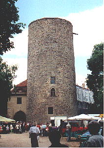
About the castle in ancient times there are no information available. In the middle of the 12th century it is built. Its founder is a vassal of the count of Belzig. The wall of the castle is 8 m high, 1,70 m wide and strengthened with pillars. Around 1200 the tower is built. It has a diameter of 30 m. For long times the castle is not easy to capture.
In 1251 people mention the name of the castle for the first time. Around 1320 to 1425 Rabenstein is owned by the family von Oppen. In 1395 it is destroyed during a fight between the archbishop of Magdeburg and the duke of Saxony. After 1425 it belongs to the possession of elector Friedrich of Saxony. In 1547 the castle gets over the war of Schmalkalden and in 1625 Erasmus von Unruh a professor purchases Rabenstein.
During the Thirty Years' War the Swedes occupy the castle. In 1665 W. Leyser buys the castle and in 1717 a chapel is built.
The military weak point of the castle is its water supply because it has no well. Before the castle belongs to the property of Rittmeister von Schönebeck from 1832 to 1848 it has several other owners.
In 1815 Rabenstein becomes Prussian. In 1956 a youth hostel is fitted out. During the last centuries the castle has endured because of the neglect. An architectural sight is the hall of knights.
 |
 |
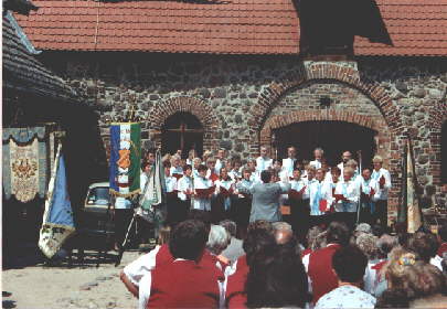
A choir contest at the castle of Rabenstein in the summer 1998 |
The entrance of the castle |
![]()
![]()